To read more local news and updates please check our BLOG PAGE
To view Geoff Jarman’s Listings CLICK HERE

Sources: City of Burnaby, Daily Hive
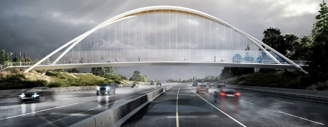
On Monday, November 21st, Burnaby City Council approved the staff’s recommendation of supporting the first location-based bridge option, which would provide a seamless connection between both sides of the highway and the recreational trails.
The staff’s recommendation reflects public input received from this past spring’s consultation.
As the first option takes advantage of the high terrain on both sides of the highway, it has the lowest construction cost of $16 million, since it reduces both the size of the superstructure and the length of the ramps.
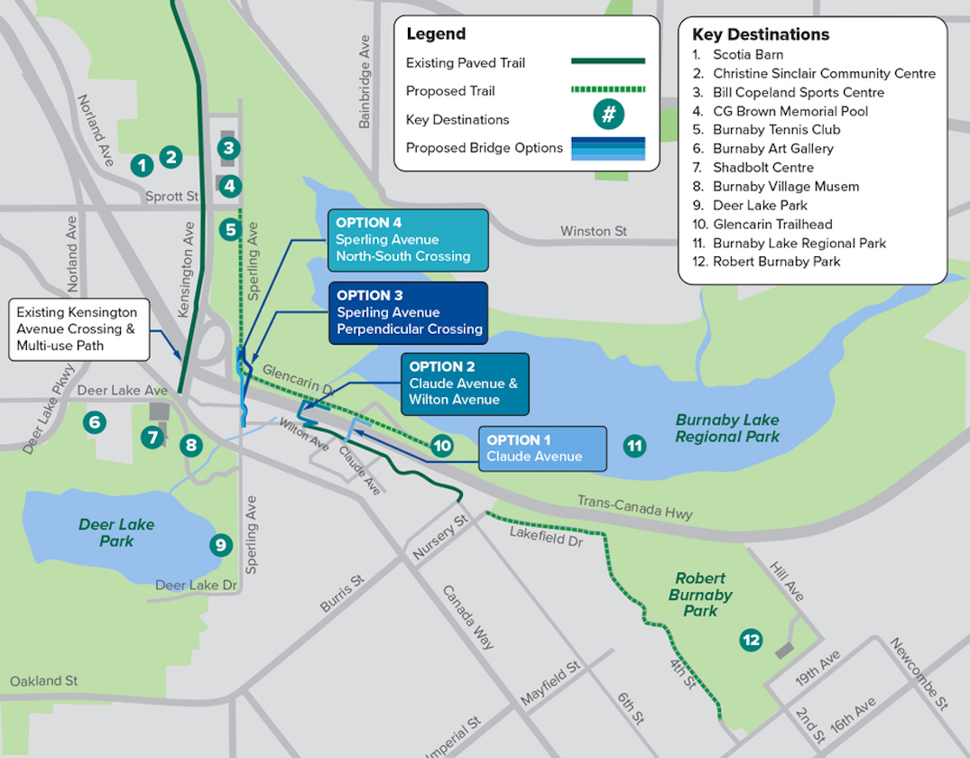
The first option is the easternmost of the four location-based options, located near Claude Avenue.

The new overpass will cross Highway 1 between Glencarin Drive and Claude Avenue, allowing residents, commuters, and visitors to cross safely and comfortably. In previous communications, this was referred to as Option 1.


The second option, just to the west of the first, is estimated to cost $19 million, while the other two, along Sperling Avenue, are estimated to cost $59 million each.
There are two options for Sperling Avenue, adjacent to the Kensington Avenue interchange on the highway, but they are challenged by the need for a larger bridge superstructure and foundation components, as well as the cost of BC Hydro utility relocation of more than $4 million.
A third and fourth option on Sperling Avenue are also not supported by the BC Ministry of Transportation, as they would limit the possibility of expanding Highway 1 in the future, such as a widening with two additional lanes or extending the on- and off-ramps at the nearby interchange.


Several city councilors expressed concerns about the location of the first option since some users would have to detour to reach the other side. In addition, all four location options are located within a 500-meter zone just east of Kensington Avenue.
Some councilors, however, noted that the westernmost options present accessibility challenges as well.
In addition to being the least expensive and shortest ramp, the first option has the least environmental impact, the least geotechnical and utility challenges, and does not require any jurisdictional consent.
Joe Keithley, a city councilor, specifically suggested that the lower cost of the first option could leave money for a future overpass further east.
The provincial and federal governments have agreed to jointly fund the project, contributing $6.87 million in total.
Construction on this grant needs to begin in 2023, which makes the case for supporting the simplest design.
To read more local news and updates please check our BLOG PAGE
To view Geoff Jarman’s Listings CLICK HERE

Source: urbanyvr.com, burnabynow.com
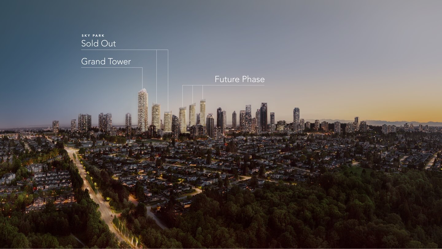
The second phase of Concord Metrotown, designed by IBI Group, includes approximately 2,000 homes (condos, non-market rentals and rentals) across three towers:
A podium with approximately 600,000 square feet of commercial and retail space will sit atop the towers. The site will be lined with restaurants and cafes along Festival Way.
The second phase continues the architectural expression of phase one, with narrow towers and light glass.
An office/hotel tower with 47 stories and a market rental tower with 60 stories are also part of this rezoning application with guidelines for two commercial high-rise buildings.
As part of a partnership with Metrotown shopping center owners Ivanhoe Cambridge, this sub-phase will be developed adjacent to the existing mall.
In spite of its proximity to SkyTrain, the development will provide more than 1,240 underground parking spaces for commercial use. A total of 4,621 bicycle parking spaces are also planned.
As part of the initial Concord Metrotown development phase, the developer was required to provide a plan for “transportation demand management” (TDM) – this included strategies like:
There will be fitness centers, meeting rooms, children’s play areas, wellness spas, work lounges, guest suites, and kitchens. As part of the project, the rooftops will also be extensively landscaped and will include lawn areas, dog runs, dining areas, seating areas, a playground, and garden plots. Additionally, there will be an extensive public art program. PWL Partnership is the landscape architect.
To read more local news and updates please check our BLOG PAGE
To view Geoff Jarman’s Listings CLICK HERE